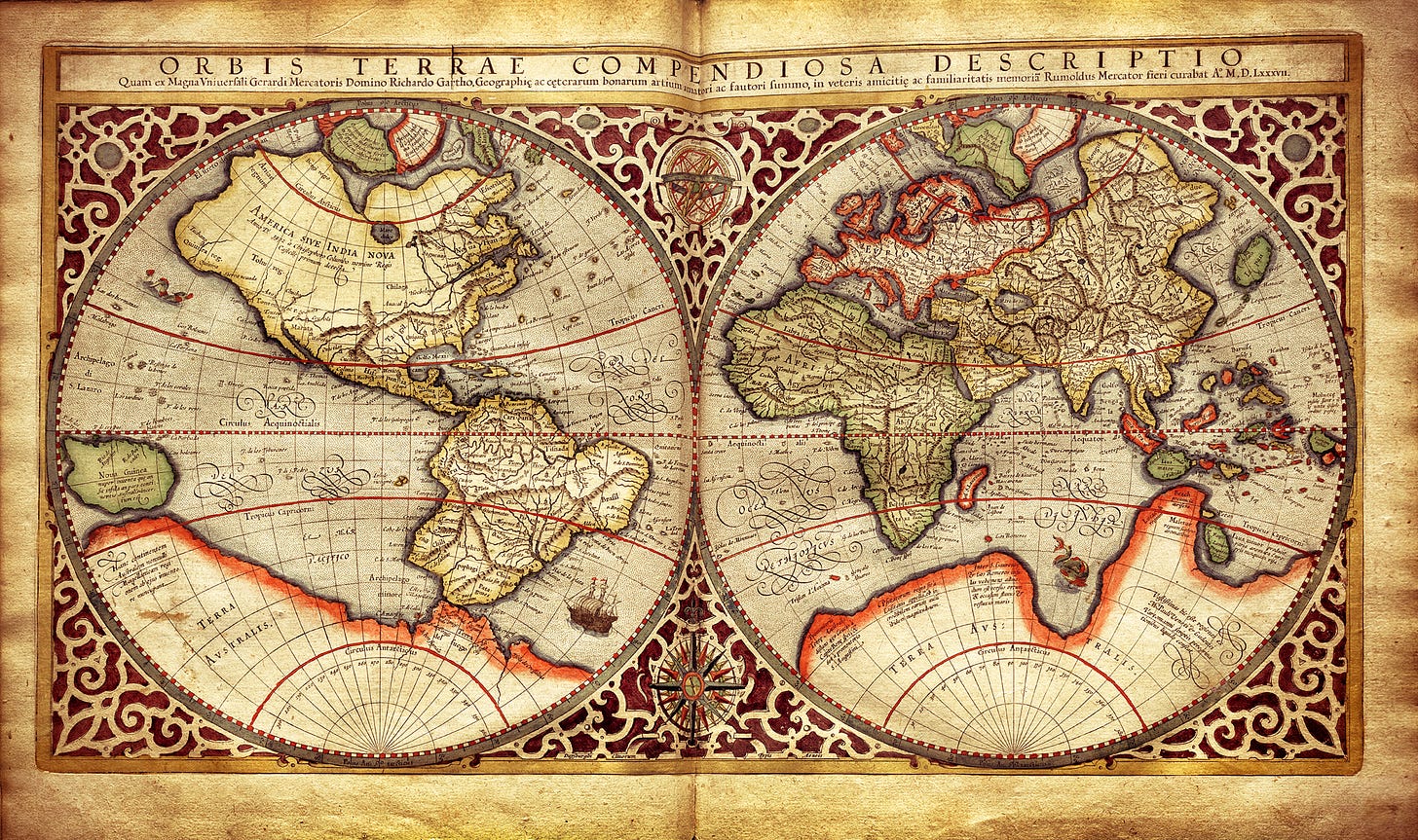
Maps can be magic carpets to the past
These time capsules of the way that the world used to be are precious
My mind is peering at a wall hanging in my living room. My mind pictures men in colonial attire smoking long clay pipes, women wearing ankle-length prairie dresses, and Native Americans using primitive implements to plant corn and other crops.
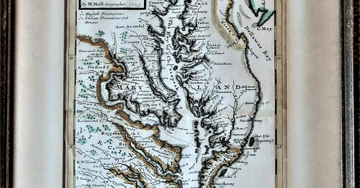
The framed image isn’t a drawing or painting but rather a small map. Some features are highlighted in hand-applied colors, and figures identify “English Plantations” and “Indian Plantations and Houses.” Written in the upper left corner is “H. Moll. 1729.”
This hand-drawn map of Maryland and Virginia was the work of Herman Moll, a well-known cartographer who lived in London. In the place spelling of that time, today’s Chesapeake Bay is called “The Bay of Chesapeak,” and the Potomac River is identified as “Patowmack.”
Maps can be magic carpets.
Maps like this, and countless others, can transport us to distant places and centuries-long civilizations. At this time of limited travel, these diagrams can serve as magic carpets taking our mind, if not our body, on mental journeys around the country and world and back in history.
For some people, maps serve as collectible time capsules that conjure up childhood memories. Others view them as windows into the world as it was – or was depicted – eons ago.
Maps and the new technologies
Depending upon your age, you may – or may not – recall “strip” maps that were available from automobile clubs and accordion-folded diagrams that gas stations provided free to travelers who purchased fuel. Today, Mapquest, Google Maps, and GPS devices have succeeded. I concede that this 21st-century technology is useful and plead guilty to using it myself.
For me, however, online depictions and directions, and the emotionless voice emanating from a GPS, lack the memories, nostalgia, and sense of discovery I get from perusing a map of – well, anywhere.
Map mysteries to explore
How did No Name, Colorado, Embarrass, Minnesota, and Accident, Maryland come to be called that? What lies just off the highly trafficked interstate highways that warrants a detour?
Maps can help answer questions that enhance the experience of driving cross-country or even in or near where you live. They also can offer a history lesson, introduce a fascinating look into the intellect and beliefs of each period of the past, and, in some cases, add an amusing interlude.
Maps in antiquity
Some scholars believe the Catalhoyuk Cave map is the oldest in the world. This map could hardly have been taken on a trip. It’s a nine-foot-wide drawing on a cave wall in what now is Turkey. Dated between 6300 and 6100 BC, the rendering represents an ancient city including a volcano and about 80 buildings.
In the 6th century BC, the Greek scientist Anaximander created what’s believed to be the first world map. In his view, the earth was shaped like a cylinder, and humans lived on the flat top portion.
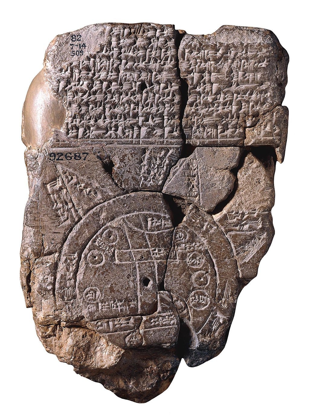
Other inventions and iterations followed. Between 700 and 500 BC, a small clay tablet placed the city of Babylon at the center of the world and broke new ground, literally, by including islands.
In a book titled History of the World in 12 Maps, British Renaissance Studies professor Jerry Brotton discusses the impact of maps over the ages, from the almost mystical representations of ancient times to present-day satellite-created imagery.
Chapters that cover pivotal periods in history include a Christianity oriented map from an English cathedral (1300 AD) which depicts the Garden of Eden, Jerusalem, and Jesus; another by a German cartographer (1507), which was the first to recognize the continent of America, and Flemish mapmaker Gerardus Mercator, who first projected the earth’s curvature onto a flat piece of paper.
Maps and mirth
Sometimes maps and mirth are wedded. That’s true on the boredpanda.com website, in a section called “40 Maps They Didn’t Teach You In School.”
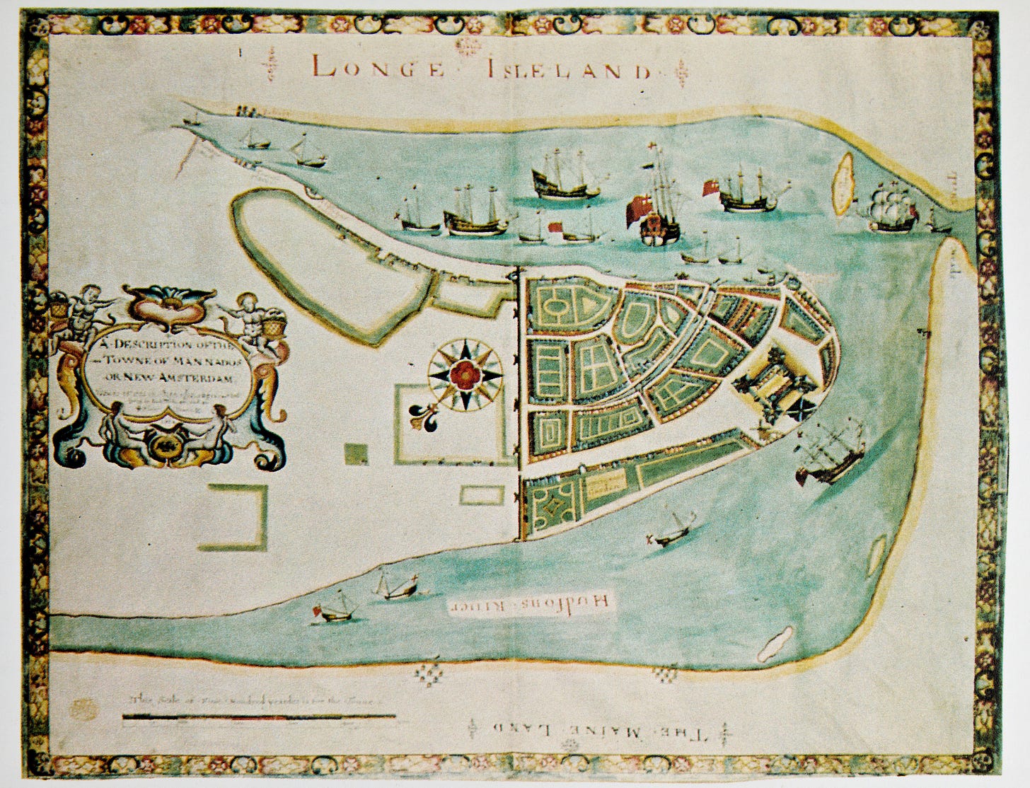
Among the irreverent representations are “The World According to Americans,” in which the United States is “Land of Awesome,” Canada is known as “Fur Trappers,” and Australia's “Kangaroo Riders.” According to “If U.S. Cities Kept their Original Names,” New York would be New Amsterdam, and Rapid City, South Dakota would have its unfortunate former name Hay Camp.
Some people use maps to seek things to check out that lie off major highways and follow random roads to discover what hidden treasures might lie ahead. For them, old, interesting, and unique maps are treasures themselves.
A marvelous map museum
One of the best collections for map museum fans is at the Map and Atlas Museum in La Jolla, California. Exhibits there underscore the fact that along with geography, antique maps encompass history, politics, creativity, and artistic beauty.
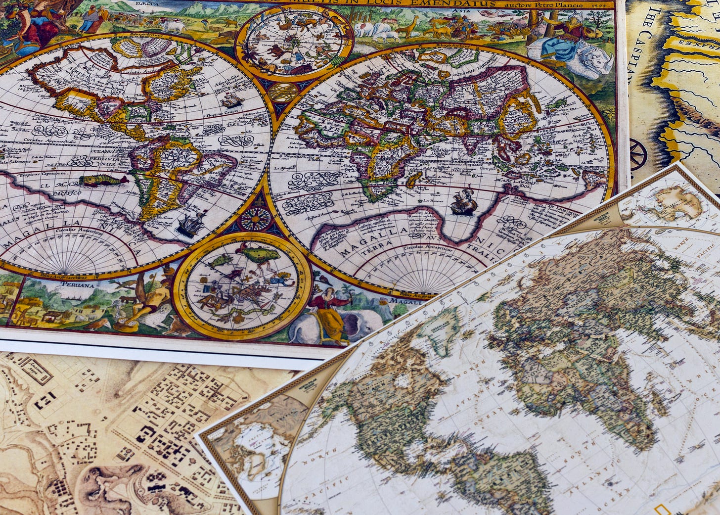
Prizes in the eclectic collection include “A New Mapp of the Whole World,” a 1738 rendering with two hemispheres and heaven, and a tourist map of South Africa (1950), whose border is decorated with colorful images of flora and fauna.
Perhaps viewing maps at museums or creating your own collection is of little interest. Even so, it can be enjoyable and educational to think about the very vital role geographic charts have played in world history. If you’re so inclined, you might like to see if you can dig up an old atlas or long-forgotten automobile map and use it to explore unknown territories on your next driving trip. Or, as an alternative, let it be a guide for a trip down memory lane.
Victor Block
After gallivanting throughout the United States and to more than 75 other countries worldwide and writing about what he sees, does, and learns, Victor Block retains the travel bug. He firmly believes that travel is the best possible education and claims he still has a lot to learn. He loves to explore new destinations and cultures, and his stories about them have won many writing awards.

