Wonderful trails surround America's cities and and large towns. Discover them.
Most people around the country can find places that provide enjoyable walks not far from their home and ‘hood.
If you are tired of looping through your neighborhoods when you are walking, discover the nearby trails, local woods, and streams.
I’ve been told that its O.K. to take walks outside, but I got bored with traipsing around my neighborhood day after day. So I’ve been hopping in my car, taking short drives and hiking in new and much more pleasant surroundings. I follow trails through pleasant woods, pass by meandering streams and enjoy close-up encounters with Mother Nature’s beauty.
Most people around the country can find places that provide enjoyable walks not far from their home and ‘hood. Opportunities beckon both those interested in a casual stroll and seasoned hikers seeking more of a challenge. Some are located in the heart of cities, others not far away. If you’re not familiar with the choices available near where you live, an Internet search is likely to reveal information about an inviting selection.
Rather than hiking along the asphalt roads of Dayton, head to the Mad River Trails and connect with paths surrounding Wright Patterson Air Force Base.
When people think “hiking,” Dayton, Ohio probably isn’t the first place that comes to mind. However, residents of that city enjoy easy access to the Mad River Trail, a seven-mile long, mostly flat paved pathway which follows its namesake river. Along the way it connects a handful of parks and parallels Wright Patterson Air Force Base. (For more information, log onto daytoncvb.com.)
Oregon is filled great hikes.
It’s not surprising that a state which is home to three of the most prominent mountains in the U.S. also is the home of outstanding hiking. Western Oregon’s mountainous region serves as a magnet for serious hikers and climbers and, along with the rest of the Beaver State, offers plenty of close-by hiking trails for shut-ins.
Portland alone is rich with inviting forests and diverse footpaths which are located within the city limits. Some lead to tranquil woodlands, others pass wetland habitats and a few wind their way up extinct volcanoes. Then there’s Forest Park, the largest urban enclave in the country, which comes alive with wildflowers as the weather warms. (travelportland.com)
Utah has some of America’s best trekking.
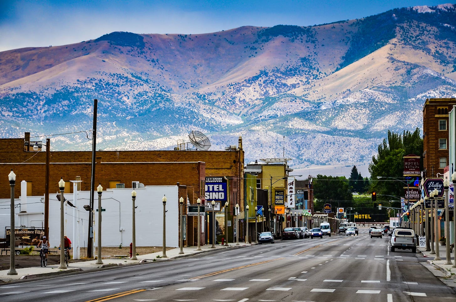
Downtown Salt Lake City, Utah also is a source of trailheads, including some that can lead to mountains in minutes. The something-for-everyone list includes gentle strolls for kid-toting parents, easy walks for casual hikers and others sure to satisfy those seeking a challenge.
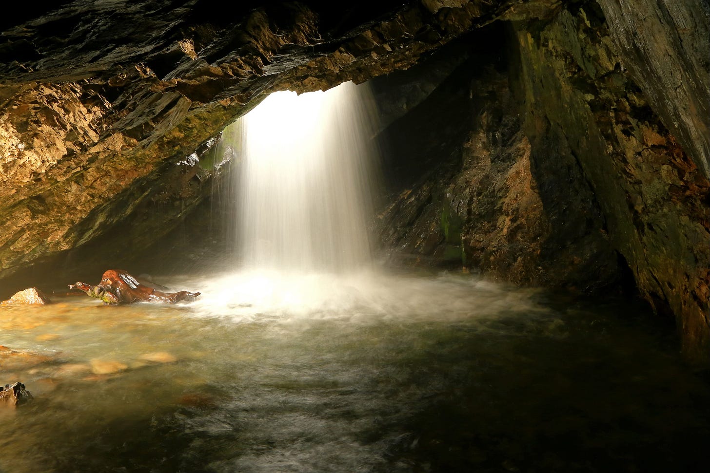
The moderate Donut Falls trail provides access to a unique waterfall where Big Cottonwood Creek spills through a hole in a cavern ceiling. The strenuous climb to the 9,026-foot high peak of Mount Olympus offers magnificent views over Salt Lake Valley. (Utah.com/hiking/salt-lake)
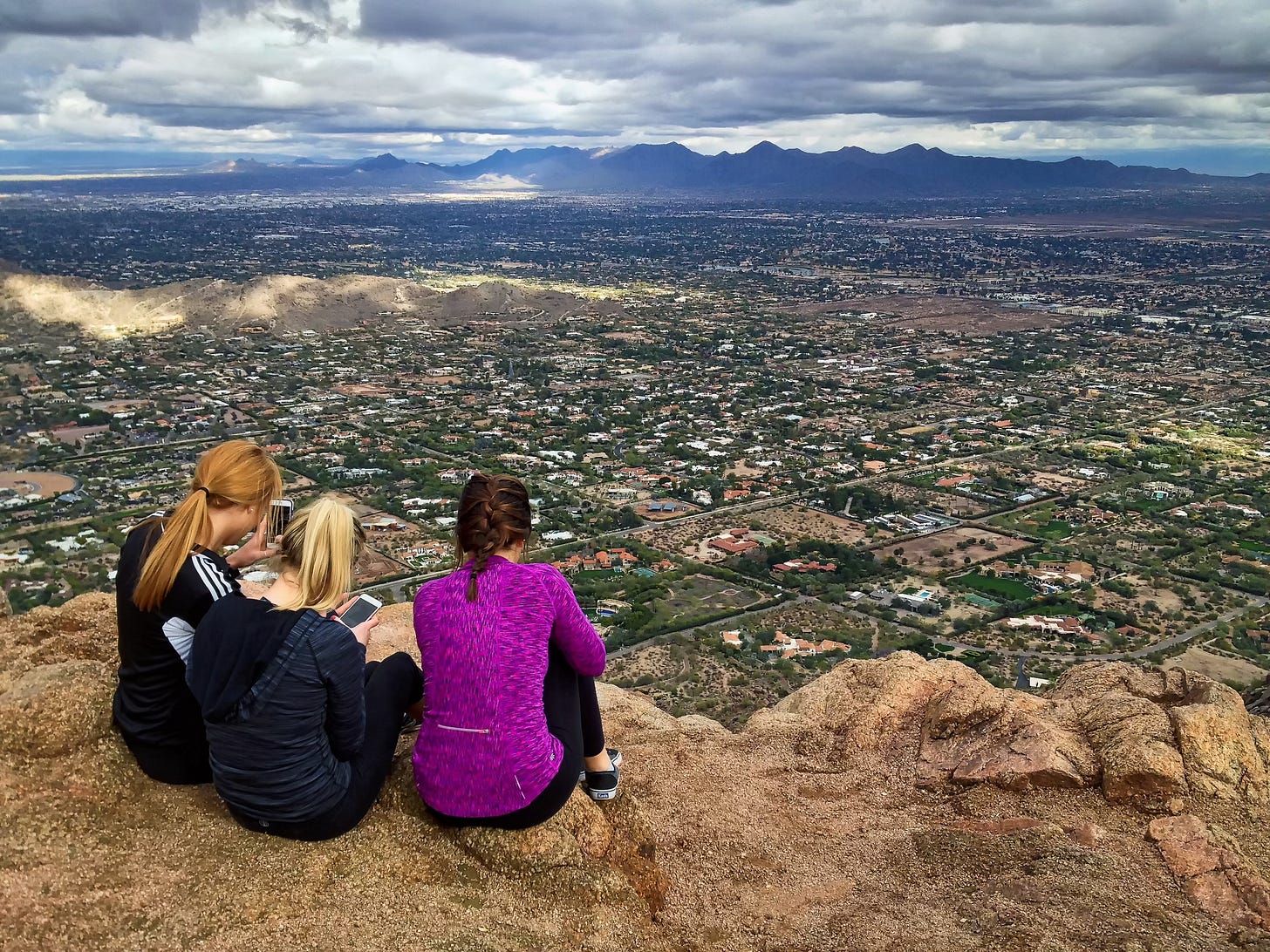
Arizona’s Camelback Mountain provides rock scrambling only 20 minutes from downtown Phoenix.
Equally challenging, and rewarding, is the ascent to the top of Camelback Mountain, located just a 20-minute drive from downtown Phoenix, Arizona. Those who follow either of two trails to the summit enjoy 360-degree views of the surrounding city. Be forewarned that both routes involve exposed rock and areas that require hand-over-hand climbing. (visitphoenix.com)
Florida offers flat elevation but miles of trails.
The terrain is very different in Florida, where the highest natural elevation in the state – Britton Hill, located in the northwestern panhandle area – tops out at a less-than-impressive 345 feet. But what the Sunshine State may lack in elevation change it more than makes up in terms of hiking opportunities – including, by one count, more than 1,200 trails.
The big attraction is the 1,300-mile-long Florida National Scenic Trail, a Congressionally designated route which snakes its way from Gulf Islands National Seashore in the north to Big Cypress National Preserve to the south. Along its way, the route passes the Everglades and showcases the culture, biodiversity and history of the state. (visitfloridacom/trails)
Discover the Pony Express trails between Missouri and California.
Speaking of history, opportunities abound to combine a walk outdoors with a walk through time, delving into chapters of our country’s past. For a short period in the mid-19th century, hardy men on horseback carried the nation’s mail between Missouri and California. It took a relay of Pony Express riders 10 days to cover the 1,800 miles.
While most of the original trail has been obliterated by time or human activity, short segments of what are believed to be traces of the original route exist in Utah and California. Other stretches may be followed by car and some are available for exploring on foot. (nps.gov.poex)
Pennsylvania, Maryland, Virginia, and DC have plenty of prepared paths through thick forests and along historic rivers.
Very different stories from the country’s past are encountered along sections of the Potomac Heritage National Scenic Trail, which wends its way through Pennsylvania, Maryland, Virginia and Washington, DC. The path leads through contrasting landscapes that lie between the Chesapeake Bay and Allegheny Plateau, and served as a westward corridor for early Americans.
People may follow in their footsteps by taking hikes of preferred lengths, which can range from an hour or two to an entire day. Among the many alternatives is a 2.5-mile walk from Ohiopyle State Park to Laurel Ridge in Pennsylvania, and the 11-mile trail that follows the Potomac River between Great Falls Park and Algonkian Regional Park in Virginia.
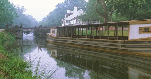
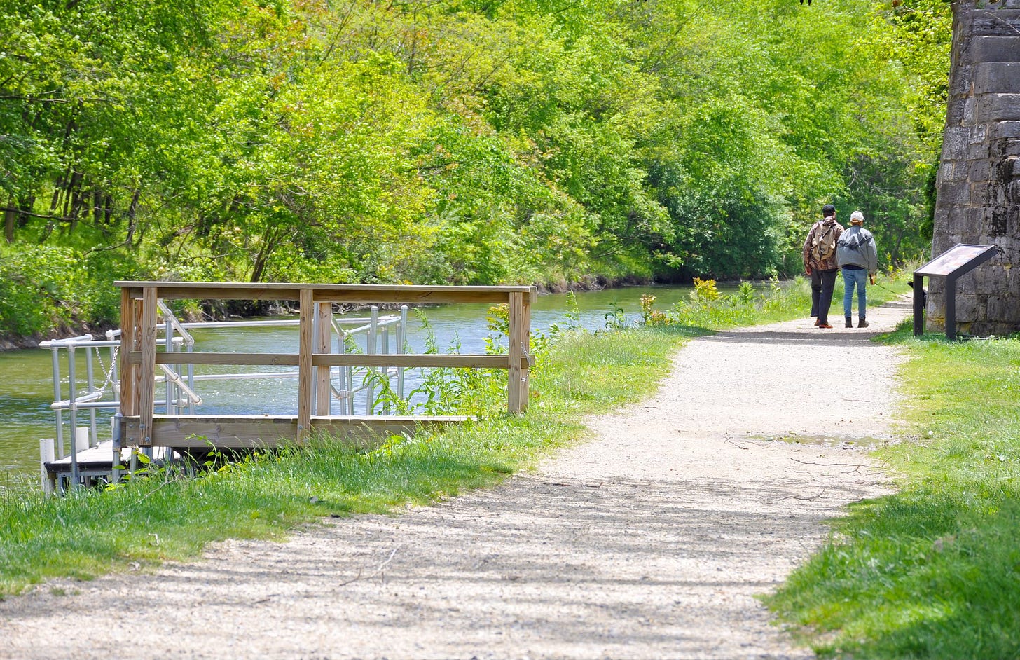
The most history-rich treks are along the tow path beside the Chesapeake & Ohio Canal, which runs 184.5 miles between Washington, DC and Cumberland, Maryland. From 1831 until 1924, flat cargo boats – originally pulled by mules – transported coal, lumber and farm produce from countryside to city. Along the way, they passed through 74 lift locks that were required to overcome an elevation change of 605 feet along the route.
The trail along the old mule towpath, which is primarily pancake flat, is conveniently accessible to people who live in the communities it connects and along its entire route. (nps.gov/pohe)
These suggestions are but a few of any across our great land.
This is but a brief sampling of both easy walks and more challenging hikes that people might consider when seeking a substitute for yet another stroll around their block or through their neighborhood. An added bonus is the scenery, history and other attributes that can add much to the quest for a bit of exercise and fresh air.
Information about popular hiking opportunities arranged by city is available at alltrails.com, and by state at traillink.com.

